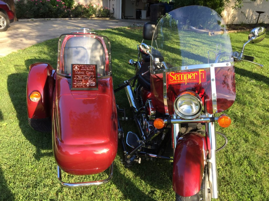
On a recent gorgeous day, just before fall harvest began, me and my buds (Mike Suess, Greg Jenner, Jason Sanders) felt the compelling need to jump on our three Hondas and a Harley and spend a day riding.
I call this group the “Slow Riders” club. That’s an unofficial name, but appropriate, since we all agreed to: a day of meandering along south central Illinois back roads; making a few strategic stops; and using the Bayer seed corn production plant at Illiopolis as our turn-around point.
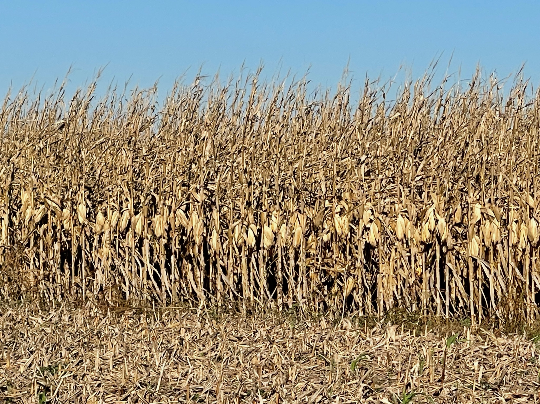
I also joked that this day was a “tall corn” tour, because most of what we would see on this trip was corn and soybean fields nearly ripe for harvest. And, I might add, they have never looked better.
Through thirty-four cities, villages and wide spots

We rode through or very near a bunch of wide spots in the road, including: Greenville, Woburn, Fillmore, Bingham, Bayle City, Ramsey, Two Churches, Wren’s Bridge, Herrick, Tower Hill, Pana, Millerville, Owaneco, Taylorville, Velma, Mt. Auburn, Illiopolis, Lanesville, Buffalo, Mechanicsburg, Roby, Cascade, New City, Beamington, Chatham, Glenarm, Divernon, Farmersville, Waggoner, Litchfield, Walshville, Long’s Bridge, Panama and Donnellson.
If you’ve been to all of those, please let me know! And all in just a 200-mile trip!
As you can readily sense, we really know how to have a good time and below are listed some of the spots where we chose to dismount and take in some local “flavor”.
We left north out of Greenville and caught the Mulberry Grove-Fillmore Road 10 miles north and and departed Bond County into southern Montgomery County. In downtown Fillmore, we turned right at the only stop sign in town and found ourselves on a well-maintained concrete road that made us all wonder, “Why is this great stretch of road out here in the middle of nowhere?” We’re still seeking the reason for that “road to nowhere”!
1. Ramsey’s former train museum – Ramsey, IL
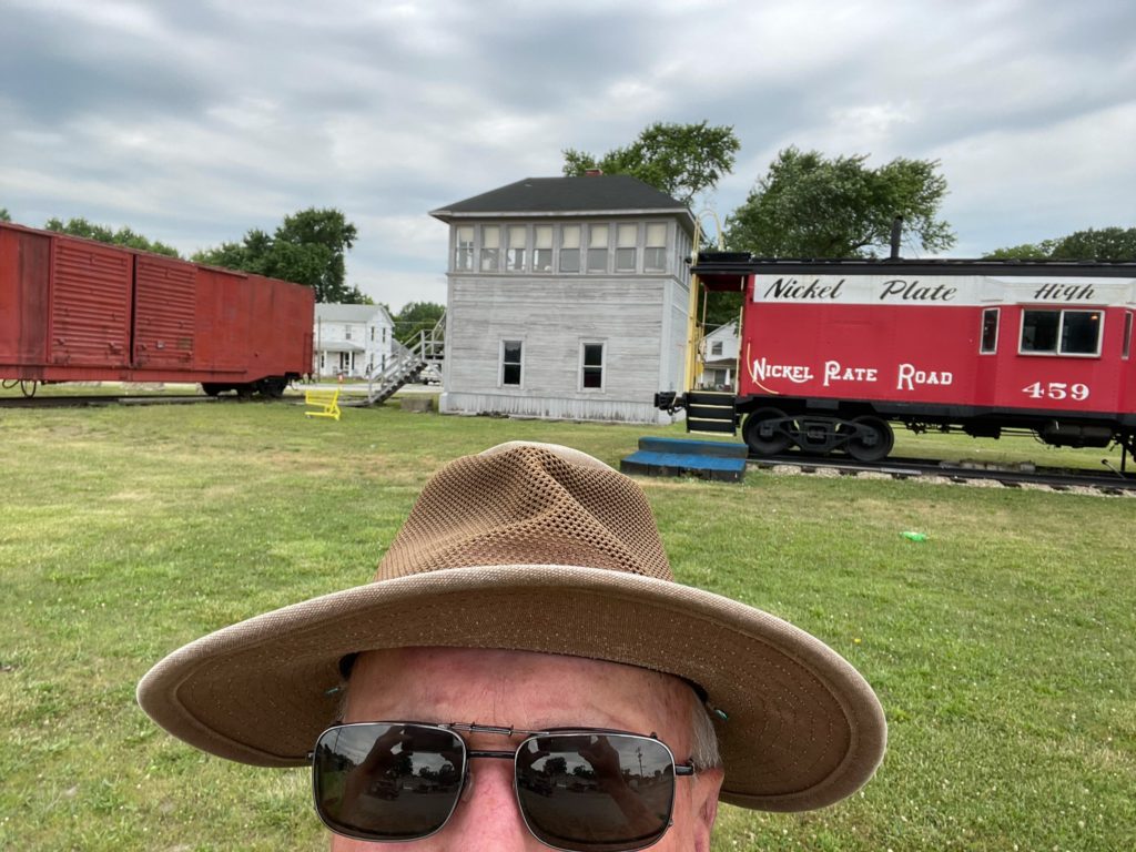
We ended up in the middle of Ramsey near where the Illinois Central Railroad intersected with the Nickel Plate Road at one time. The Nickel Plate Illinois Central Interlocking Tower, a box car, and a Nickel Plate bay window caboose stand as a testament of bygone days when the intersecting railroads made Ramsey a prosperous hub.
The three comprised a railroad museum for several years, until its closure in 2016, and it is still well-kept, even if no longer maintaining open hours. Visit www.vandaliaillinois.com for more information.
2. Solar Farm – Ramsey Township, IL
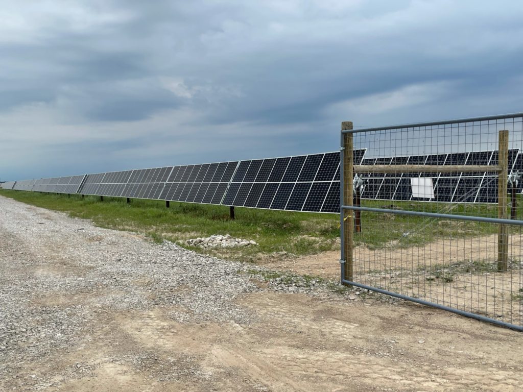
After taking a look at the past, drive four miles east on CR2800 N to Dresser Plains Solar, a new energy producing farm in east Ramsey Township, and gape at the site of several hundred acres of freshly built solar panels on a state-of-the-art solar farm for a glimpse of the future.
If solar is to be one of our nation’s clean-energy solutions, then we will all need to get used to seeing fields filled with structures like those in this $100 Million project.
3. Wren’s Bridge: The Springs and the Cross-Carson Township

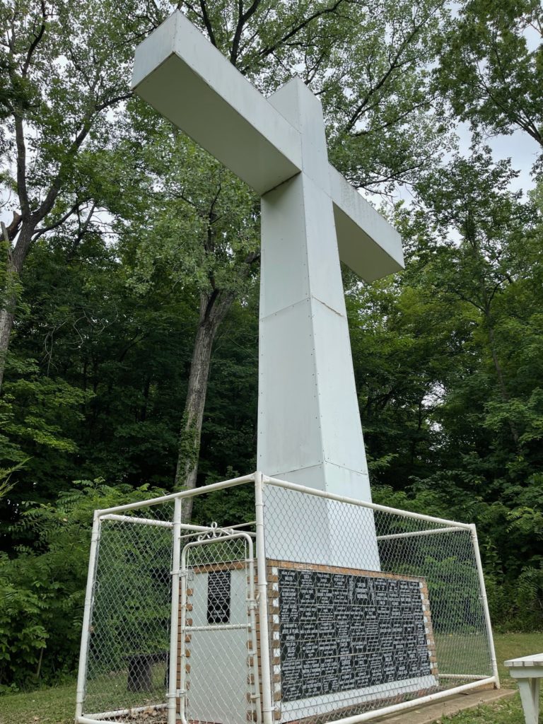
The 40′ tall cross and local memorial near Wren’s Bridge. 
Area folks flock to draw water from the spring near the cross at the site of the former Wren’s Bridge.
Four miles further east and a little bit south, the main road crosses the Kaskaskia River. But before you cross the bridge and on a side road off to your right, you will find the spot where Wren’s Bridge was erected in 1898 and stood for several decades. Some of the concrete from the bridge remains, but there are two other sites to see nearby.
A 40’ tall cross was constructed in 2005 as a memorial to honor the folks who settled and labored in Carson Township.
A couple of hundred yards away are constantly running springs of fresh water that have had a water wheel and pipe added over the years, so that area residents can easily fill jugs for home use. These improvements make this a great stop on a hot summer day.
4. My honey’s birth home – Herrick, IL
Turning north on the Herrick Road, allowed us to pass through the tiny town of Herrick, which is where my wife’s family lived when she was born. She only lived there as a baby and there is no monument to be found, but heading out of town north, leads you to Tower Hill, which is situated on IL Hwy 16. Beginning to have hunger pangs, we turned west on Hwy 16 and drove through Pana on the way to Taylorville.
5. Charro Mexican Restaurant – Taylorville, IL

Charro Mexican Restaurant was recommended by the clerk at our gas stop and turned out to answer our lunch needs extremely well. 
Every lunch platter looked this appetizing.
The 11,000 population Christian County seat town of Taylorville serves partially as a bed-room community for Springfield and Decatur. We made a fuel stop there figuring to have a large selection of restaurants from which to choose and asked the attendant for a local recommendation. What we found was the surprising Charro Mexican Restaurant & Bar that had an unusually large amount of seating for a town this size.
The owners had started years ago in a small facility, but eventually took advantage of the availability of an empty mall to expand their seating capacity and also add a health facility next door.
And yes, the food lived up to the recommendation.
6. Bayer seed corn plant – Illiopolis, IL

Adequately nourished and fueled up, we headed north on CR1400E for 10 miles, passing the hilltop village of Mt. Auburn, before reaching our turn-around point of Illiopolis. Our reason for driving to this town located on old US Hwy 36 was the existence of a seed corn production plant currently owned and operated by Bayer. I visited here often from 1986-1992 while serving as a DeKalb district sales manager.
DeKalb had converted a former WWII ammunition plant at this location into a seed production facility many years ago and it has seen several major renovations and new construction to make it the state-of-the-art facility it is today.
Although, we had not started corn harvest in our home area in Bond County, we fully expected it to be beginning near the plant. Truckloads of ear corn arrived every few minutes for processing, but since no fields in the area had been harvested, we realized the crops were coming from further north, so we did not get to see any active harvesting during our ride.
7. Historic Route 66 – Springfield to Litchfield, IL

After spending some time watching the processing at the seed plant, we turned our trusty steeds southward with the intention of heading southwest, going around Lake Springfield on the southeast side.
We met up with Historic Route 66 (known to many as the Mother Road for its long history as a major east to west highway) east of Chatham and headed south using frontage roads along Interstate 55 with Litchfield as our destination of choice.
That 40-mile stretch proved to range from some smooth sections to some that were washboard rough enough to jar your teeth. So, extremely slow speeds were sometimes necessary.
A final stop at the Casey’s in Litchfield allowed for a much-needed snickerdoodle to re-charge our personal batteries for final 35-mile jaunt cross-country through Walshville and Panama and back home to Greenville.
Season ending ride
It was a nice finale’ to what could be the end of the riding season, covering roughly 200 miles with only about 15 miles of actual highways, and if you are country boy enough to think of endless fields of soybeans and corn as “beautiful scenery”, then this would be a trip tailor-made for you.
