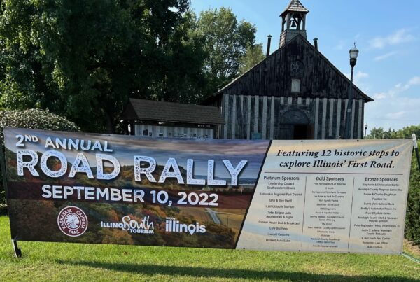
On a recent 90-degree day, my traveling partner, wife Jane and I decided to take a trip that we hoped would give us maximum photo opportunities with a minimum of time spent outside of our air-conditioned vehicle. We did a quick map study and decided to tackle the Ohio River Scenic Byway (ORSB).
The ORSB is one of seven America’s Byways that wind through Illinois. It runs for 188 miles parallel to the Ohio River and serves as the border between Illinois and Kentucky. We decided to drive the border, knowing that we would miss seeing the beauty of the eastern interior part of the Shawnee National Forest, but then there will be another day for that exploration.
Old Shawneetown, IL
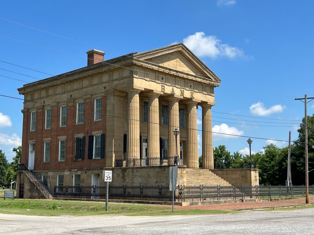
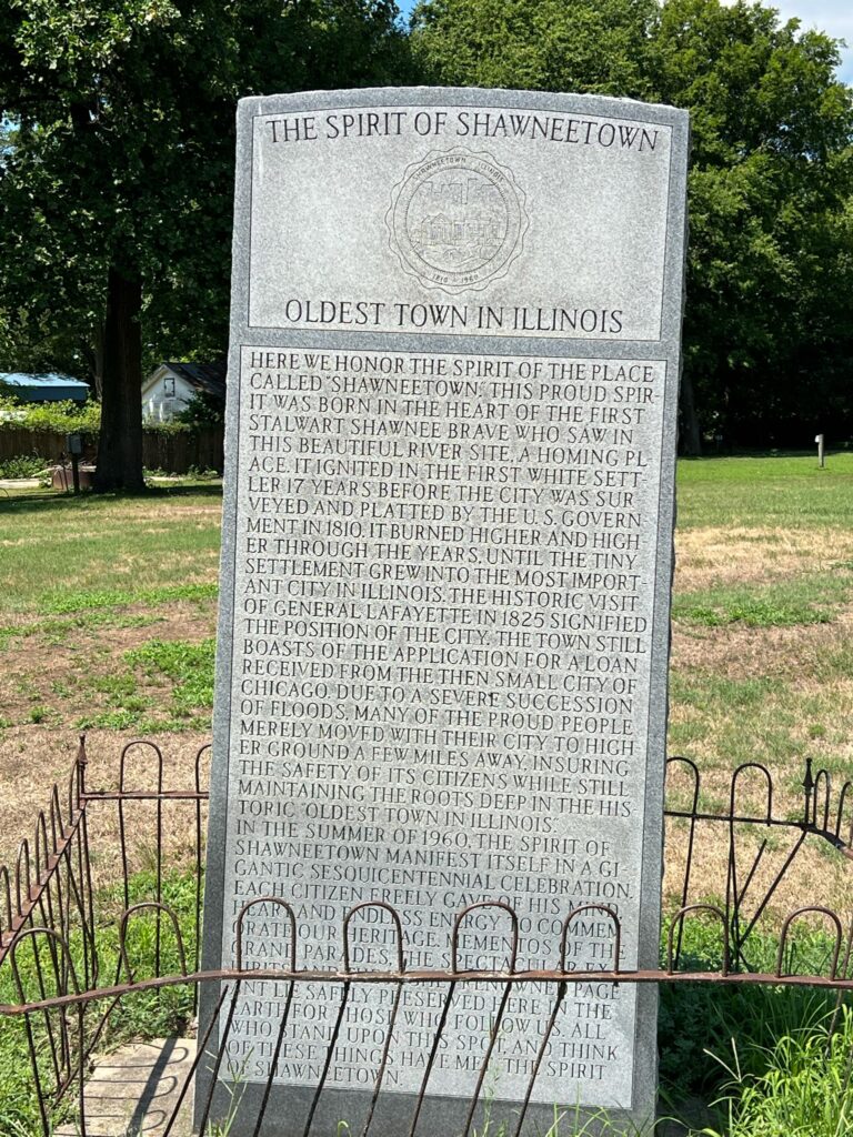
About a dozen miles south of the confluence of the Wabash and Ohio Rivers, where the states of Illinois, Indiana and Kentucky meet, is where much of Illinois’ early history began. Shawneetown (now Old Shawneetown) boasts of being the oldest town in Illinois and it is perched along the Ohio River in a relatively low-lying area, which eventually proved to be its undoing. A disastrous flood in 1937, after years of being threatened by consistent high water, was the final straw as the town moved three miles west to its current location on higher ground.
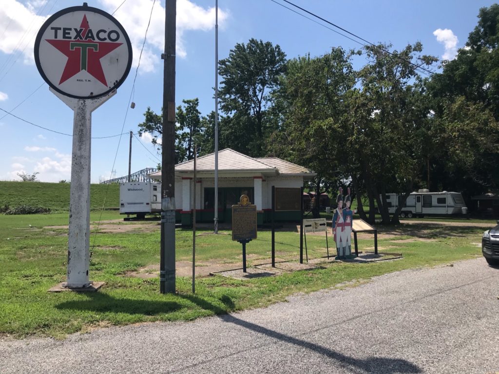
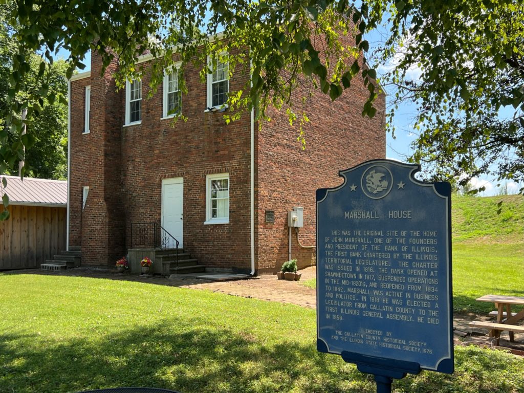
Safely tucked behind a levee, the old town has remnants of a once prosperous downtown with three old bank buildings and several other business structures, like an abandoned Texaco station. Nearby monuments explain the history of the town and about Lewis & Clark’s passing through on their way west.
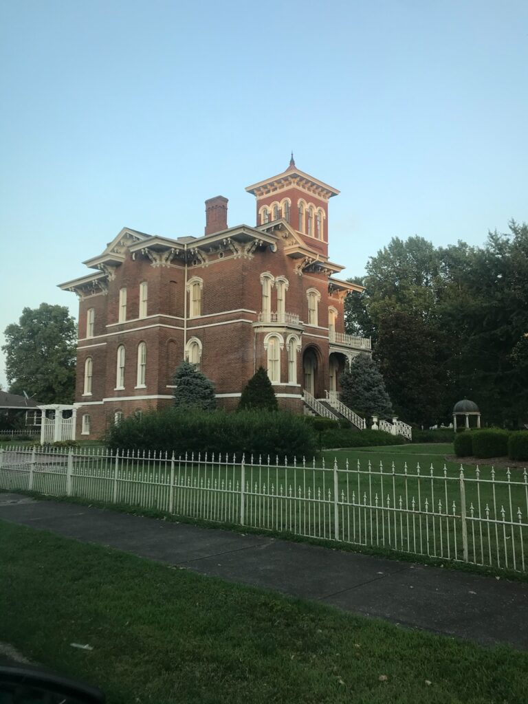
Shawneetown, IL
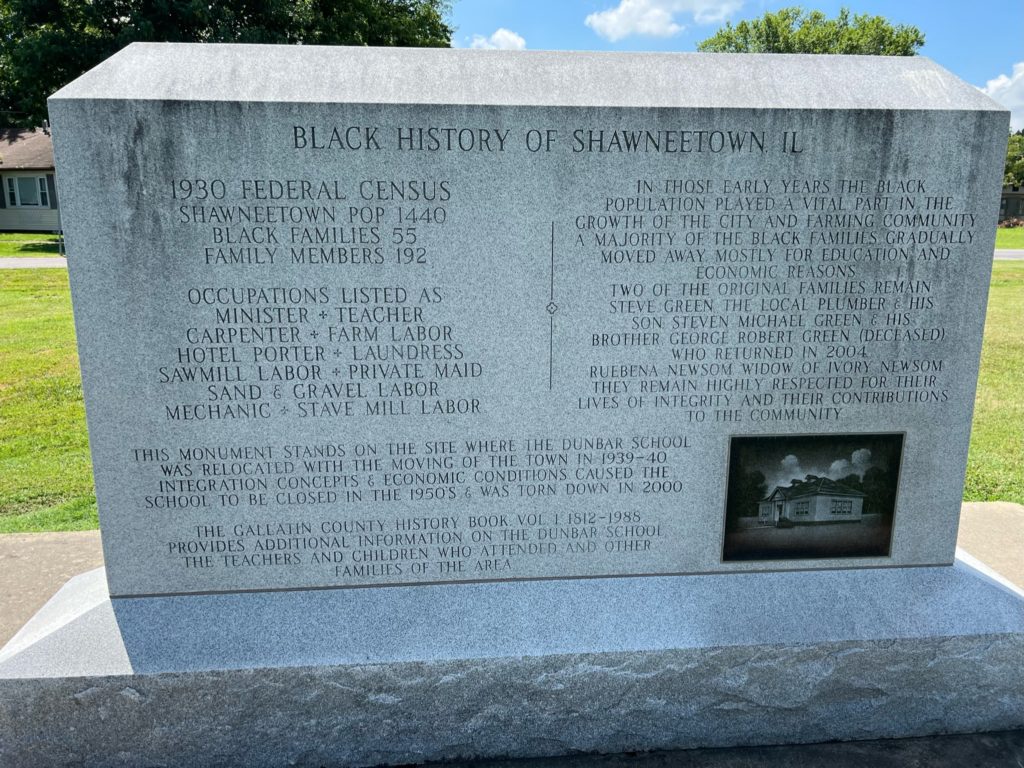
In the new Shawneetown safely above high-water levels, residents erected a monument to the Black families who settled in this area. For many blacks, crossing the Ohio River and getting into Illinois was the road to freedom.
Equality, IL
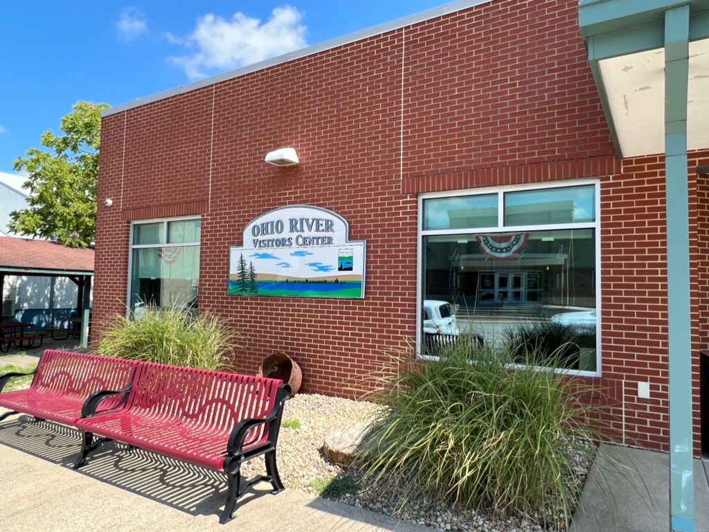
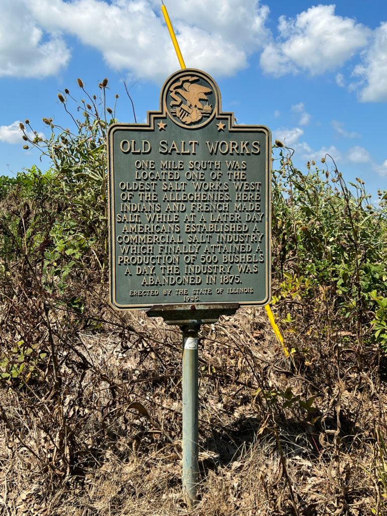
Heading further west, the village of Equality is considered the gateway to the ORSB and also the northeast approach to the Shawnee National Forest. It is home to the ORSB Visitor’s Center, which is a “must-see” stop on the trail. The town, at one time, was also home to the Oldest Salt Works west of the Alleghenies where French and Indians had previously made salt. The mines were abandoned in 1875.
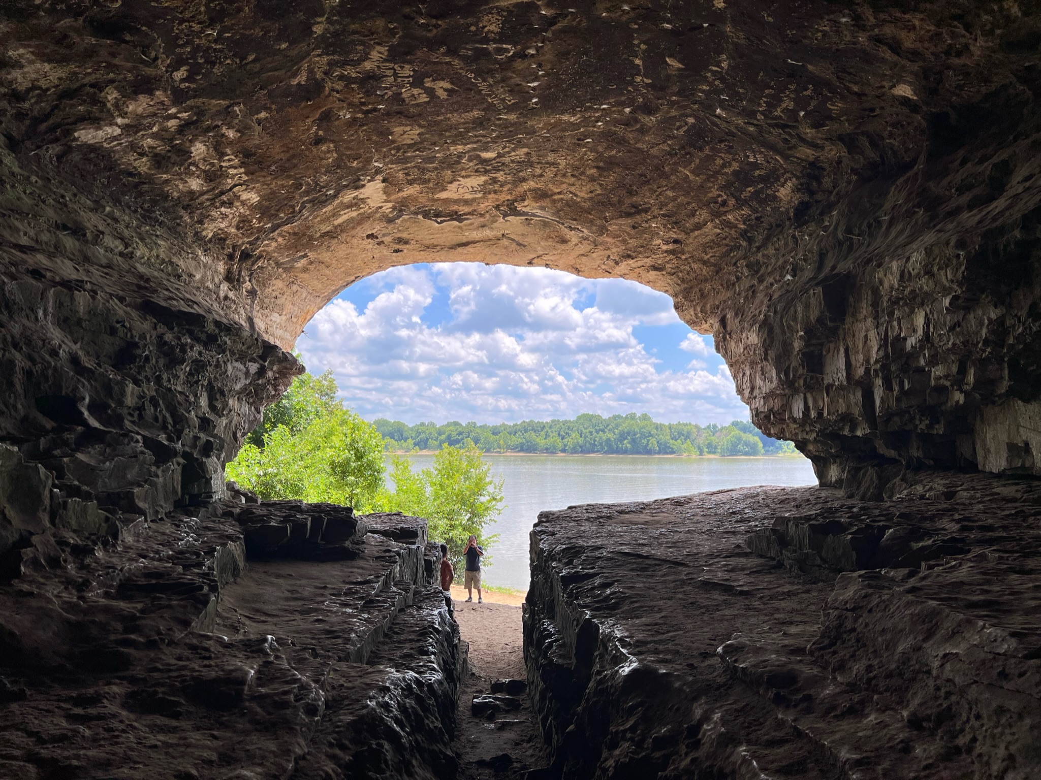
Cave in Rock State Park and Lodge
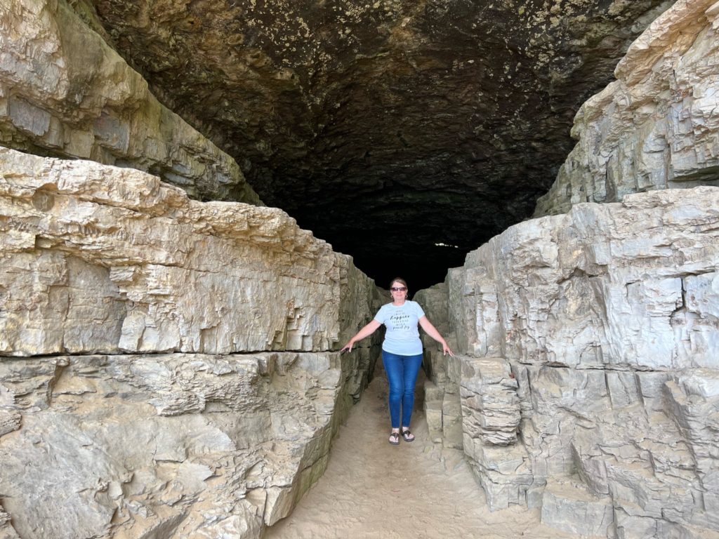
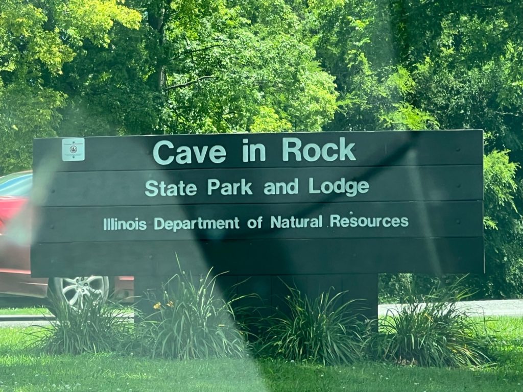
Head south on IL Rt 1 and you will take a deep dive into the Shawnee National Forest. Don’t stop until you reach the ferry crossing at Cave-in-Rock. Take a left and go through town about a mile north into Cave-in-Rock State Park. There are RV spots, camping areas and cabins available and a restaurant that serves up tasty catfish.
Make your way down the steep walk-way to the cave, which is at river level and you will learn that a scene from the 1962 epic film, “How the West Was Won” with Jimmy Stewart was filmed there. You can explore on your own or join an interpretive tour led by a park ranger to get more details. This park may be one of the least known gems among the Illinois state park system. For some quiet time away from everyday life, Illinois’ first state park looks like the perfect place.
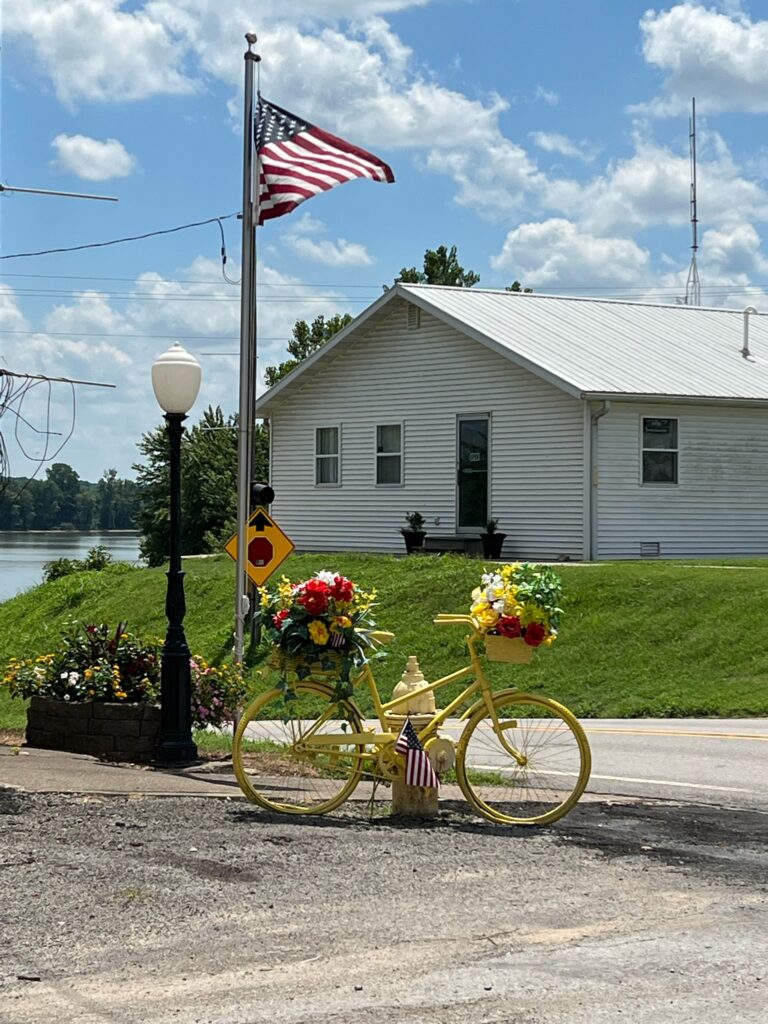
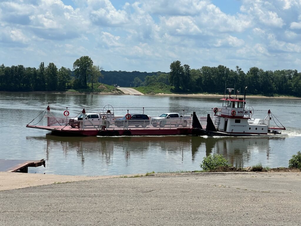
While in downtown Cave-in-Rock, be sure to notice brightly decorated bicycles in front of businesses and homes or take a ride over and back on the ferry to peek at Kentucky.
Elizabethtown, IL
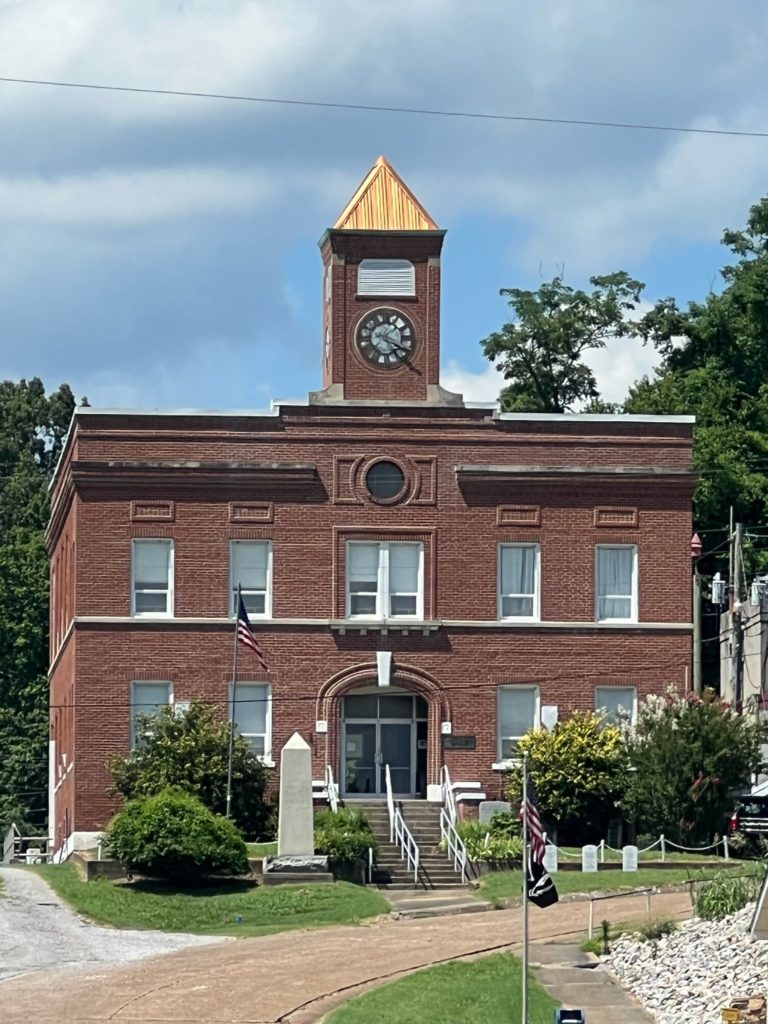
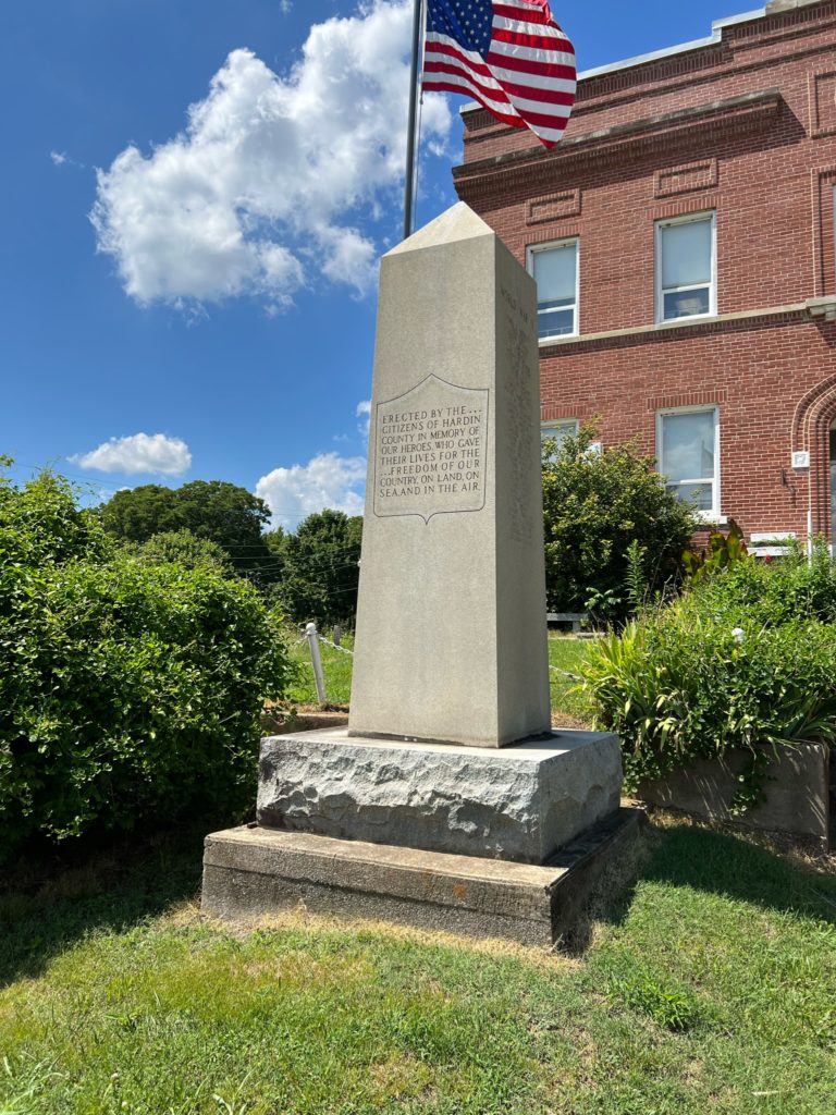
A scenic drive (perfect for motorcyclist) west through the forest will get you to Elizabethtown, which is the county seat of Hardin County. The courthouse was erected in 1926 and veteran’s memorials have been added to the grounds.
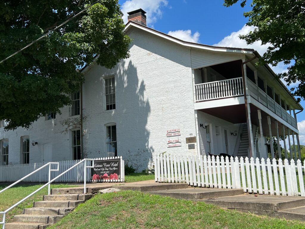
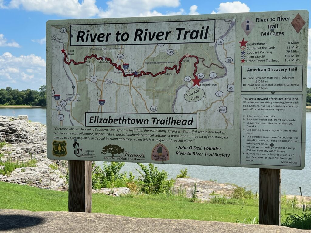
Two blocks south at the bank of the river is a large sign that shows a map of the River to River Trail for those ambitious enough to hike or bike the 152-mile path across the state. Erection of the historic Rose Hotel began in 1812 and is perched nearby. It is the perfect spot for weary outdoor lovers to recover from their strenuous treks by lounging on the large front porch of the oldest hotel in the state.
Just a few miles north of town of is the site of the first charcoal fired iron furnace in Illinois. Pig iron was smelted there and then shipped via the Ohio River to Mound City to be used to build iron-clad gun boats used in the Mississippi River campaign in the Civil War.
Rosiclare, IL

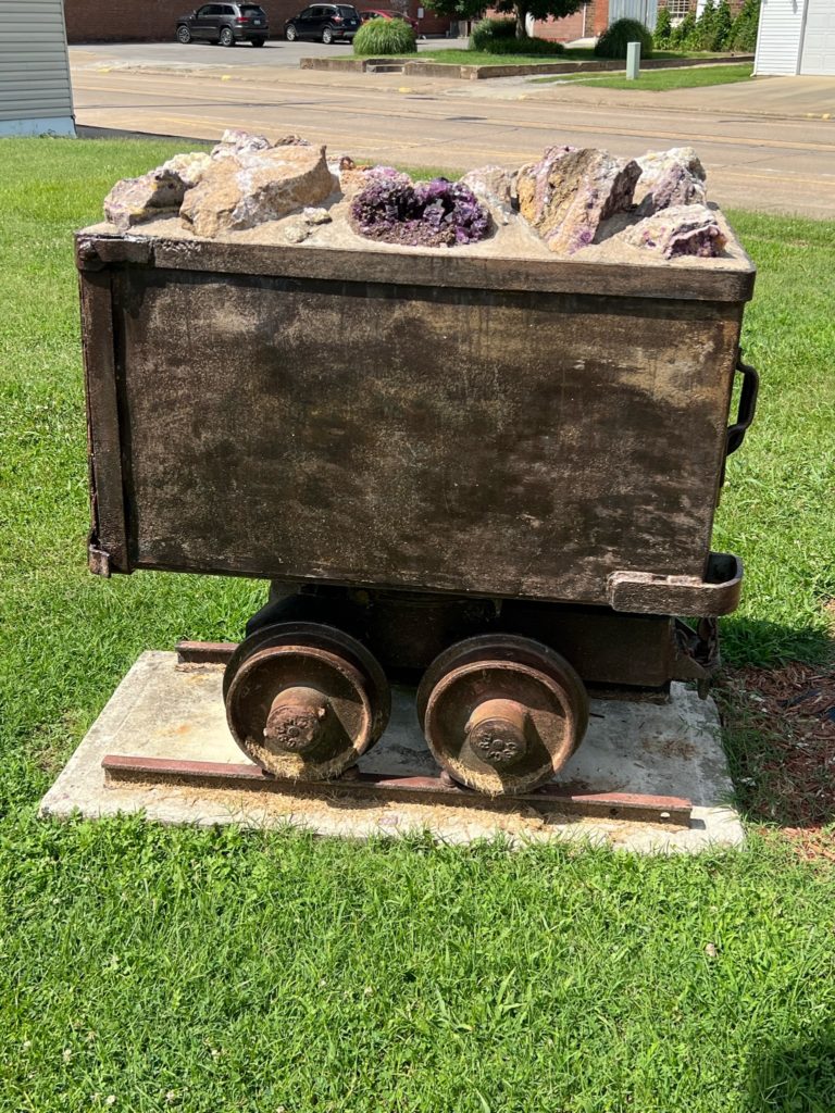
Two miles further south lies Rosiclare, a town that was once the “Fluorspar capitol of the World”. A miners’ memorial, museum and cart can be found in the middle of town. Abandoned railroad tracks run through town from the mine through the levee to the river, where it was used to transport the fluorite to river boats. The primary use of fluorite is as flux in the manufacture of steel.
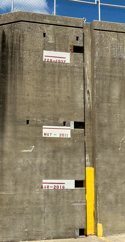
Standing on the road that goes through the levee that sits well above the current river bank, you can see marks painted on the levee showing the flood levels of the 2011 and 2018 floods and the 1937 mark near the top of the levee. The latter flood being the one that led to the movement of Shawneetown.
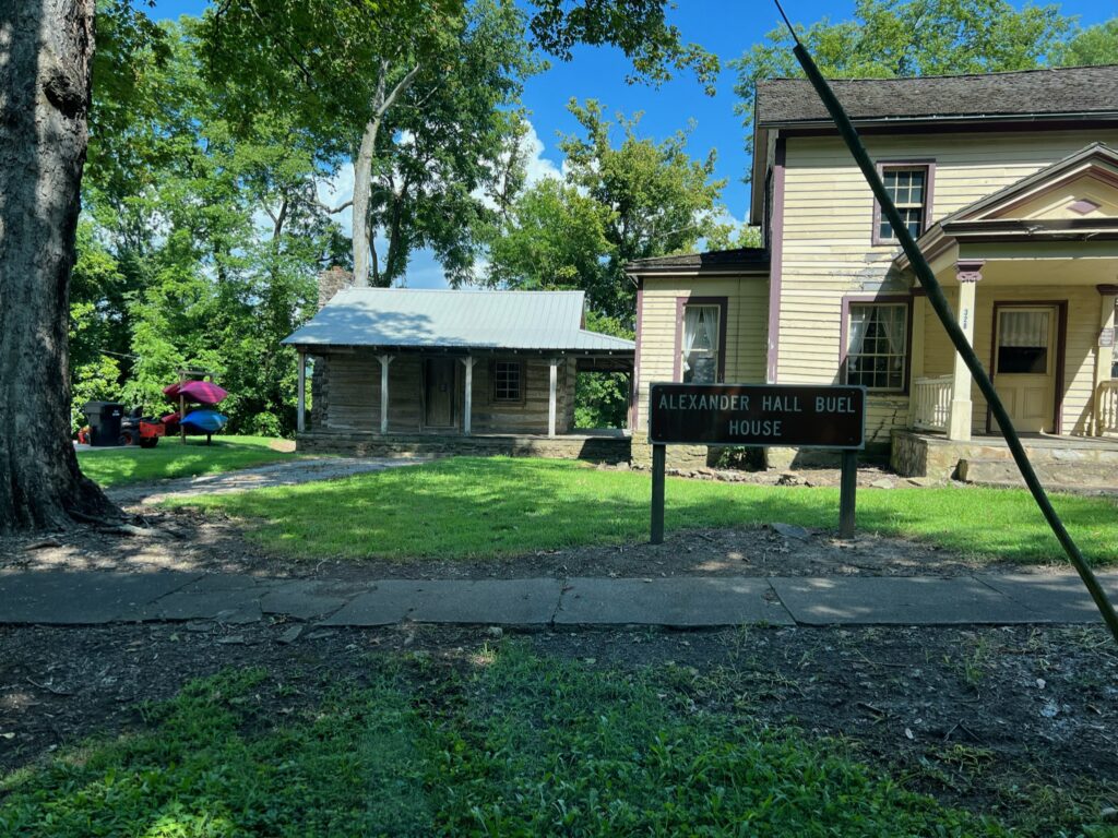
Golconda, IL
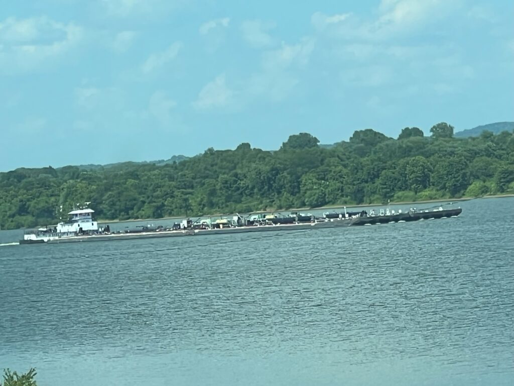
Ten miles further south through more miles of scenic Shawnee National Forest, lies a perfect spot from which to watch barges churn slowly up and down the river and that is from atop the levee at Golconda. Founded by Sarah Lusk in the early 1800’s and originally called Sarahville, this village is the location where she established a ferry across the Ohio River that grew into a town.
The Buel House, which was built in 1837, stands as a testament to time, since it was around for the forced movement from North Carolina to Oklahoma of the Cherokee people via the infamous Trail of Tears.
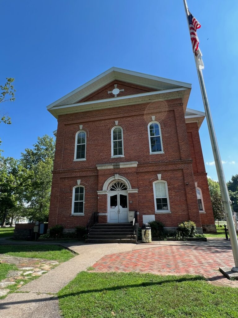
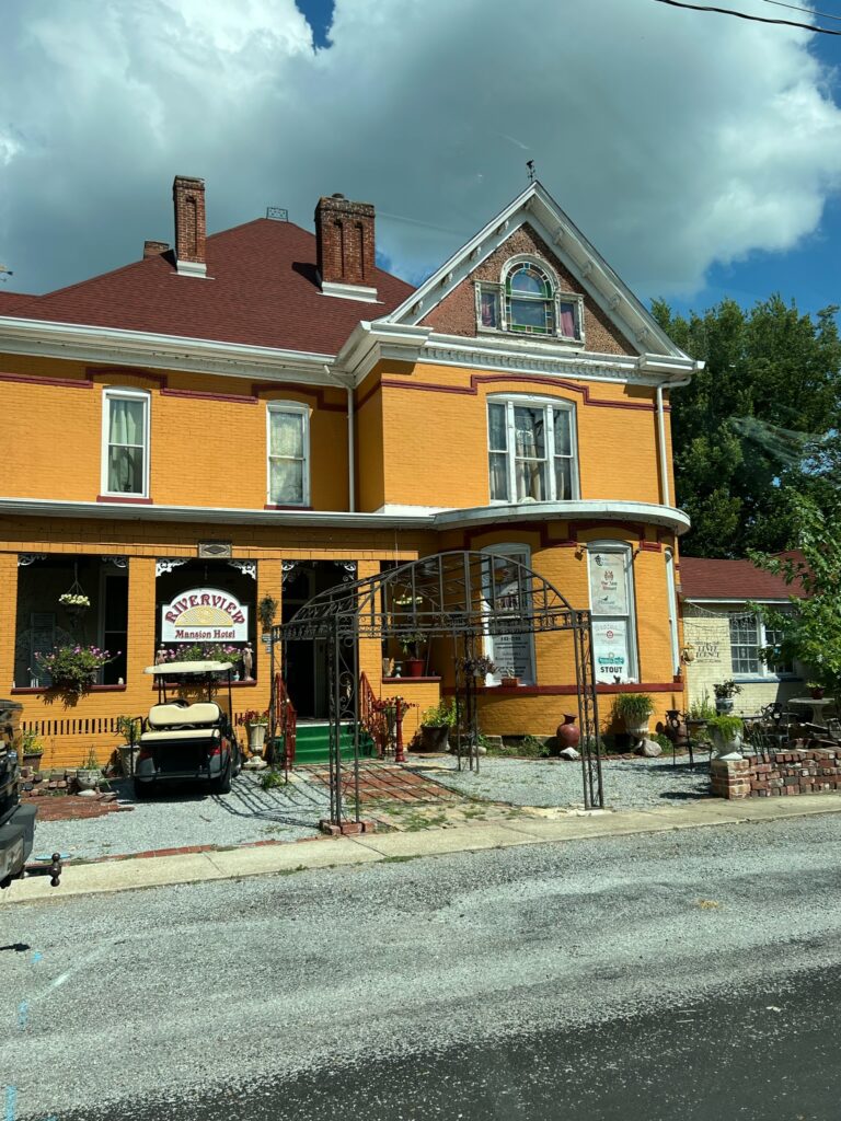
If you are looking for an overnight stay, the Riverview Mansion Hotel provides close proximity to the river and downtown Golconda, where you will find the Pope County Courthouse and war memorial.
Just down river a few miles is the largest twin navigational system, the Smithland Locks and Dam and visitor’s center.
Brookport, IL
Driving across Pope County south of Golconda, keep driving west by south through a mostly wooded area for about 20 miles until you reach Brookport and the southeast corner Massac County. Tucked in the flood plain near the river is the Kincaid Mounds State Historic Site. This is the oldest historic site on the Byway dating back to 1050-1400 AD when the mounds supported the homes, temples and buildings of Native Americans living in the area. An archeological field day is held every October and a viewing observation platform is available year around.
Metropolis, IL
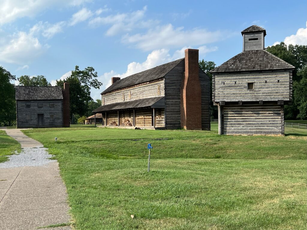
Heading west, you will eventually reach the east edge of Metropolis, where you will find a miniature replica of Ft. Massac along with a museum. This strategic point on the Ohio River has seen Indians, the Spanish, French and English occupy it long before the United States even cared about it.
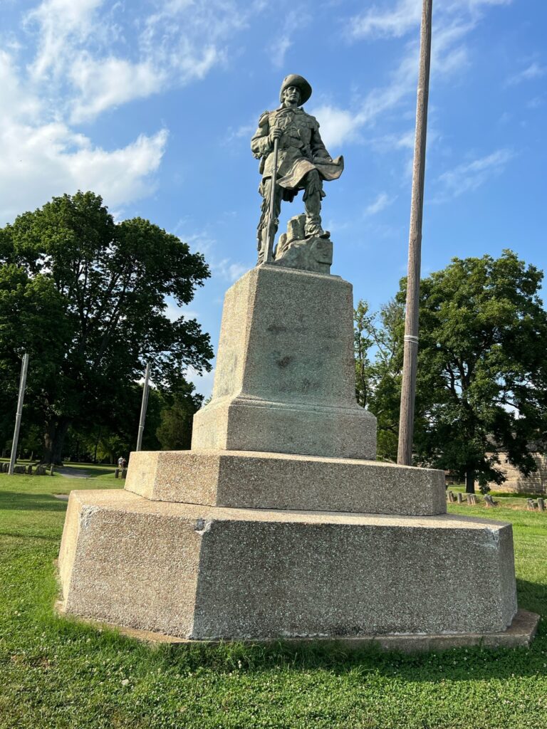
A monument to the adventurous George Rogers Clark stands by the fort, to remind one and all of the significance of his efforts to claim the Northwest Territory, which lay north of the Ohio River.
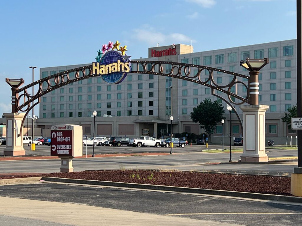
Heading downtown, you will pass the Metropolis Hope Light, which encourages the fight against cancer. If you need a diversion, a short stop and/or stay at Harrah’s Casino and Hotel on the river can take care of that need.
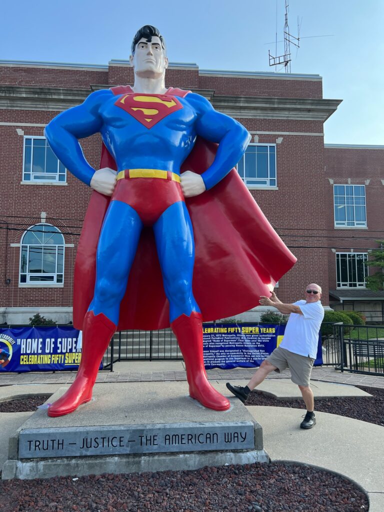
Since 1972, Metropolis has been legally considered the “Home of Superman” (Thanks to permission from DC Comics.) and I doubt that anyone leaves town without taking advantage of a photo op with his 15′ tall bronze likeness.
The statue has undergone a serious transformation in the 50 years of Superman’s presence in Metropolis from a seven-foot-tall fiberglass that locals riddled with bullets to the super-statue of today. I wouldn’t take aim at it now since bullets may ricochet like they did off of Superman. And don’t forget to visit his museum too or get a photo as Super Girl.
Olmsted, IL
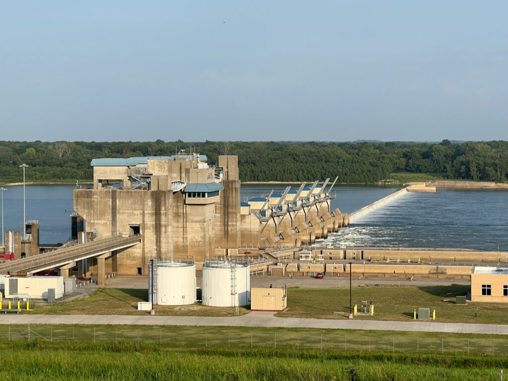
Heading west out of Metropolis, closely follow the well-marked Ohio River Scenic Byway across the tip of the state on several backroads until you reach a scenic overlook just off of IL RT 37 that allows you to gaze down on the Olmsted Lock & Dam. This structure is the largest inland river project ever constructed by the U.S. Corps of Engineers.
Downtown Olmsted has an old railroad depot and a caboose that serve as a reminder of when several railroads converged into a hub in Cairo, just a few miles down the road.
Mound City, IL
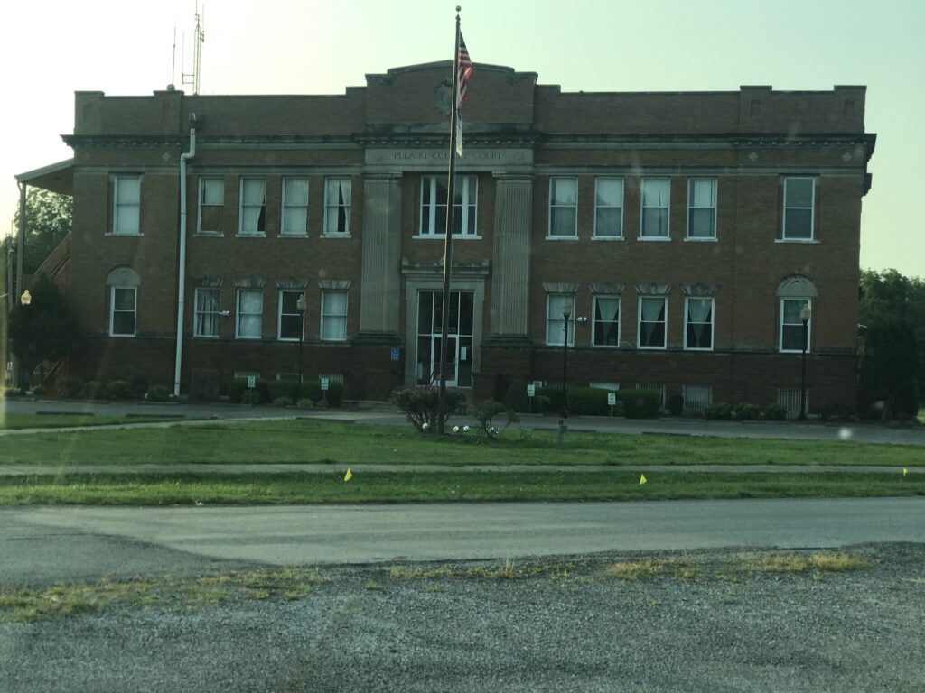
The Pulaski County Courthouse is in the center of Mound City, which was a bustling community during the Civil War. It was home to ship building, including the iron-clads that patrolled and controlled the Mississippi River, and a Union military hospital.
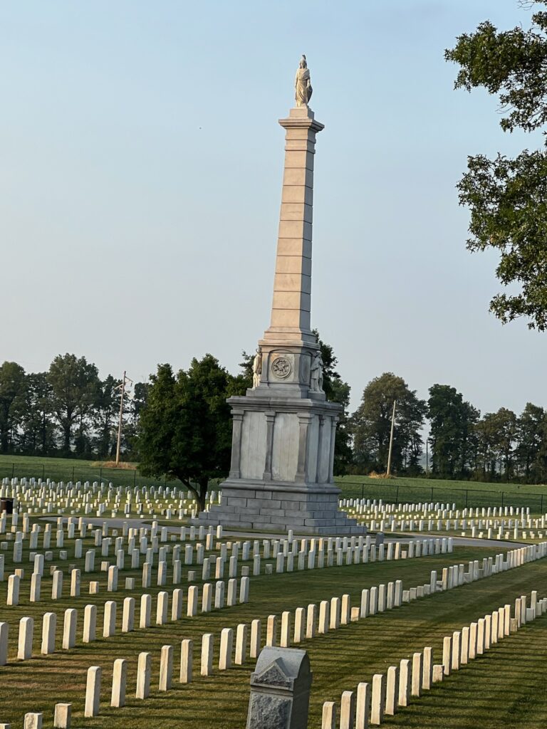
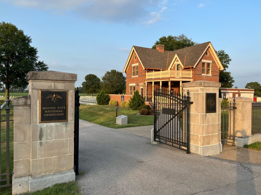
Just outside of town is one of the original 12 national cemeteries developed during the Civil War. This pristine cemetery was established in 1864 and houses the remains of 2,700 unknown Union and Confederate soldiers and one “Confederate spy”. It was located here because of its proximity to the Mound City Military Hospital. The caretaker’s house has been renovated into a visitors’ center and museum.
Cairo, IL
At the tip of the state and at the confluence of the Ohio and Mississippi Rivers, lies Cairo, a once prosperous town of 15,003 people in 1920, that now is home to 1,700 residents, which is less than their 1860 population. This is a low-lying town that is protected by 64’ levees on all sides and once bustled with activity created by the presence of railroad terminals and the ferry boats to haul goods across the rivers. It is the southernmost town in the state and the county seat of Alexander County.
It served as a “gateway” to the South, before the building of the Mississippi bridge in 1929 and the Ohio bridge in 1938, which pretty much eliminated the ferry boat industry, a major employer at that time. Cairo had a strategic importance during the Civil War, as troops moved through to fight on the western front. Today the dominant business is an ADM grain terminal through which mountains of grain move down the Mississippi and out into the world.
In 1978 another cruel blow came, when Interstate-57 from Chicago to New Orleans crossed the Mississippi five miles to the north, bypassing the town entirely and severely crippling the hospitality industry. There are a few motels and no abundance of restaurants in the city.
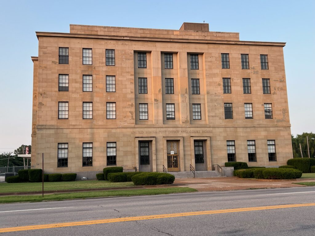
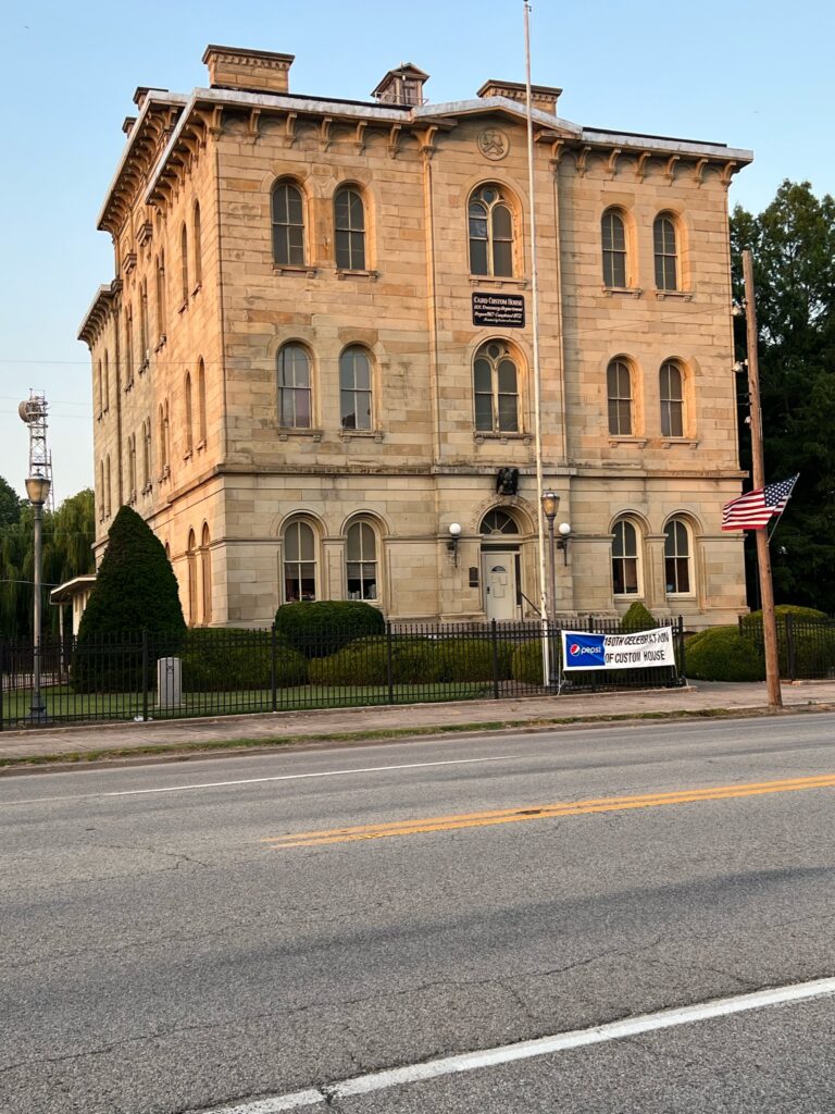
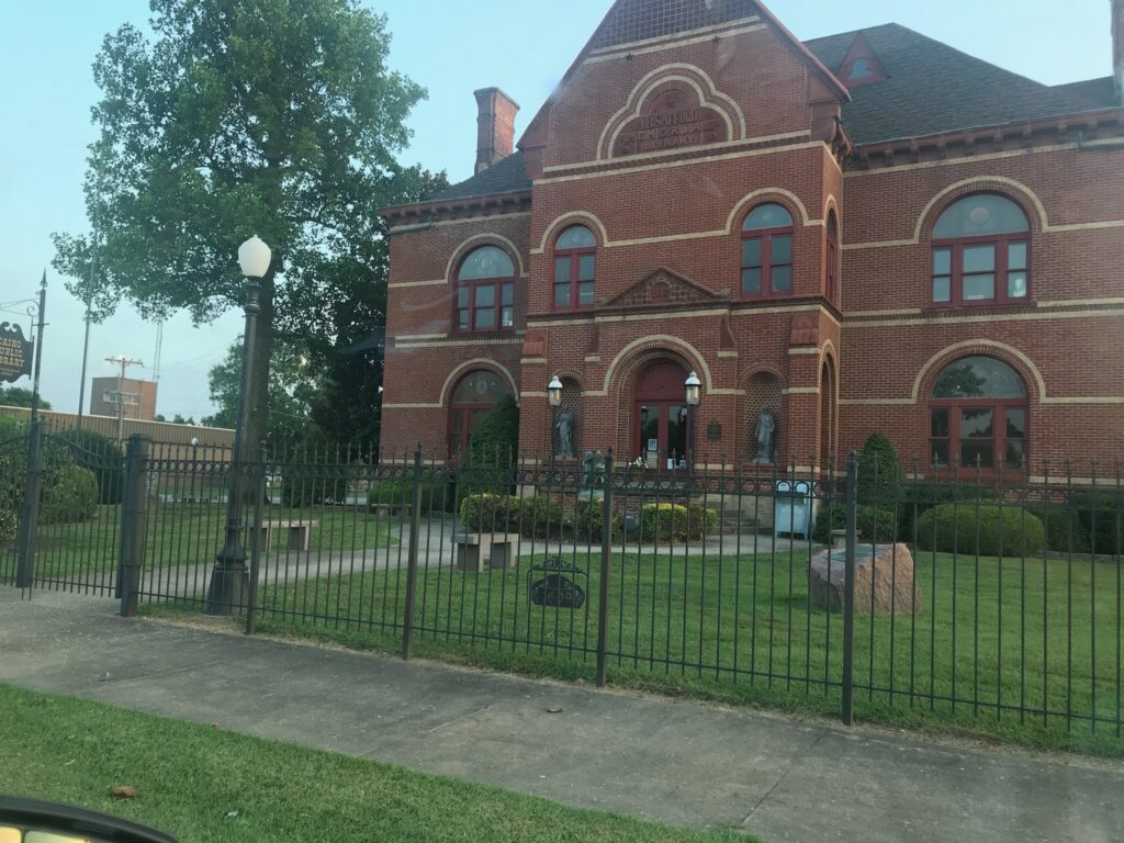
To see signs of its once-upon-a-time prosperity, visitors will want to venture downtown to visit the US Post Office /Court House (built in 1942); the Old Custom House and Museum (finished in 1872); and the Cairo Public Library’s A.B. Safford Memorial Building (a Queen Anne-style structure that was built in 1883).
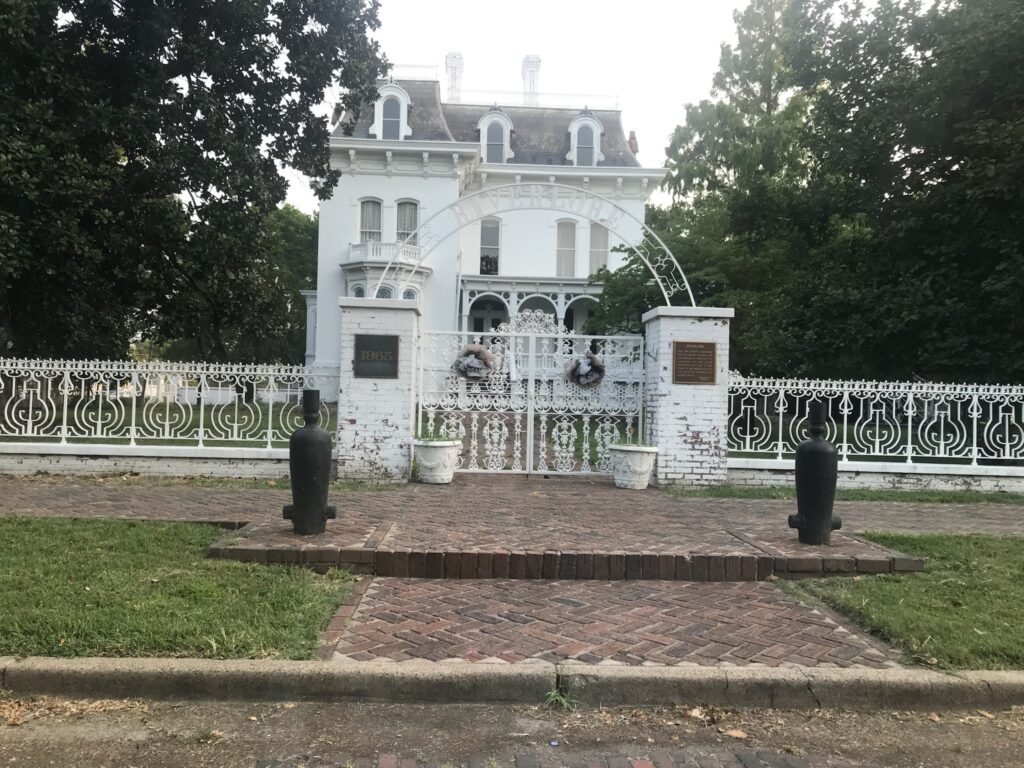
Wealthy shippers and merchants built mansions like the Second Empire Riverlore Mansion, which was completed in 1865, and the Magnolia Manor, which opened in 1869. They are now part of Cairo’s Historic Park District.
South of town two miles is the somewhat run-down Ft. Defiance Park, which was a Civil War jumping off point for Union soldiers headed to the western front. It is now an Illinois state park. Near to the park are the approaches to the bridges that go over the Ohio and Mississippi Rivers.
Conclusion
Although this is a full day of driving, don’t be deceived into thinking that Southern Illinois is all historic buildings and river ports. The interior of the seven counties gracing the southern tip of Illinois is loaded with greenery, hiking and biking paths, natural wonders, streams and hills, that can offer you and your family endless chances to “get physical”. Stand by for those tales to be included in future blogs. Meanwhile, good traveling!!
COPYRIGHT: Permission must be obtained to reprint this blog post or any material contained on this website.